Its name means leaf
The district was once called Mapavri. In Laz, pavri means “leaf” — so, “the leafy place”. A Kiepert map from 1854 marks the settlement as “Mapavra”. The present name arrived with tea.
Mapavri → Çaybaşı → ÇayeliRize · Eastern Black Sea
A place whose name means “leaf”, that climbs from sea level to two thousand metres within twenty kilometres, and where two languages are spoken in the same district. What to know before you go, what to see, what to do — on one page.
Kolik Bungalow › Çayeli Guide
Start here
Not postcard trivia — five things that actually matter once you are there.
The district was once called Mapavri. In Laz, pavri means “leaf” — so, “the leafy place”. A Kiepert map from 1854 marks the settlement as “Mapavra”. The present name arrived with tea.
Mapavri → Çaybaşı → ÇayeliAbout 18% of Turkey's tea-growing land lies within Çayeli. Before tea, these slopes grew corn; today every hillside is a set of terraces in slightly different shades of the same green.
Harvest: May — OctoberÇayeli Copper Operations has been running in Madenli since 1984. The local economy rests on tea and copper together — the second face of the district, rarely mentioned in travel guides.
MadenliThe town sits at 13 metres; the Rize Mountains to the south pass 2,000. Morning at the sea and afternoon on a highland plateau is geographically possible — few coastlines rise this sharply in such a narrow strip.
Sea → highland, same dayLaz is spoken in the eastern parts, while several mountain villages are Hemshin. Food, music and place names carry that duality; the origin of village names can change from one valley to the next.
Laz and HemshinHistory
The story of Çayeli is the centuries-long answer to one question: who held this stretch of the Black Sea coast?
The first settled community here is held to have been Milesian colonists; Roman, Byzantine and Pontic rule followed.
The ruins standing above the road tunnel, 2 km east of town, are thought to date from this century. Çayeli was one of Byzantium's frontier points on the coast.
The region joined the Ottoman Empire with Mehmed the Conqueror's Trabzon campaign. Çayeli remained a border point for roughly fifty years afterwards.
Coastal settlements suffered raids arriving by sea — part of why the Black Sea coast stayed scattered and set back from the shore for so long.
The German cartographer Kiepert marks the settlement under this name. The word comes from the Laz root for “leaf”.
The township was renamed Çaybaşı in 1943; on 1 September 1944 the district was founded and took its present name — a name pointing straight at its new crop.
Copper mining begins in Madenli, adding a second industry alongside the tea economy.
Route
All of them inside Çayeli — five stops you can reach without leaving the district.
On the Şairler stream, about 12 km from the town centre. The water falls roughly 30 metres and reads as a white line from a distance — hence the name, from the Turkish for “whitening”. You can swim in the natural pool below in summer.
12 km · easy walkA long valley holding villages such as Buzlupınar, Çataldere, İncesu and Uzundere. The district authority's “Senoz Ecovalley” project is opening it to ecotourism — which makes now the right time to see it before the crowds.
Valley routeThe Buzlupınar bridge dates from the 1800s, has a wooden roof and is still in use. Four more historic stone arch bridges line the Şairler Valley — all on the same cycling route.
1800s · wooden roofTwo kilometres east of town, directly above the road tunnel. It stands in ruins — do not expect a restored fortress. Its value is the view, and what it tells you about why this coast was worth holding.
12th century · ruinsKito (Gito), Zargistal and Ambarlık among many others. İncesu (Marbudam), with its old mosque and fountain, sits at 2,063 metres — the point where you climb out of the mist into blue sky.
up to 2,063 mItinerary
Short answer: walk, climb, eat. The longer answer depends on the season and how many days you have.
During harvest the whole district is doing one job. Stepping into a garden and picking leaves for a couple of hours is the shortest route to understanding the place — basket on your back, slope under your feet, shears in hand. The tea tastes different afterwards.
The path to Ağaran follows the stream. In summer you can swim in the pool; the day after rain the flow rises and the falls are at their most photogenic.
The Kaptanpaşa — Uzundere — Zargistal — Kito — Meydanköy line is the region's established safari route. The road is unpaved and needs 4×4; go with a local operator rather than your own car.
Çayeli — Şairler Valley — Ağaran Waterfall runs about 24 km and crosses four historic stone arch bridges. There is climbing involved, but the distance is modest — half a day.
The town centre sits right on the sea. Anchovy in winter, kuymak with cornbread in summer — whatever the season gives.
In Çayeli rain is not a setback, it is the default weather. Driving the village roads of the Senoz Valley through the mist beats most things you would do on a clear day.
Nearby
Most of the Eastern Black Sea's well-known stops are within a day trip of Çayeli.
18 km west. Rize Castle, tea gardens and the city seafront.
Up the Fırtına Valley: Ayder plateau, hot springs, the foot of the Kaçkar range. About 80 km / 90 minutes.
A medieval castle standing above the forest in the Fırtına Valley — the region's best-known silhouette.
Two highlands known for their wooden serander architecture and sea-of-clouds views.
The eastern neighbour. A short coastal drive; Kız Castle is nearby.
To the southwest, known for Anzer honey and high alpine meadows.
People
For a small district there is a striking pattern: most of the names Çayeli produced left their mark in government.
Grand Admiral · Grand Vizier
Born in 1813 in the Hemşin village of Çayeli, today called Kaptanpaşa. He married into the family of Mahmud II, commanded the Ottoman navy and served as grand vizier. The village still carries his title.
Jurist · Member of Parliament
Born in 1906 in Çataldere, part of Kaptanpaşa. He became known as the prosecutor who served in the aftermath of the 1939 Erzincan earthquake, and later spent many years as an MP for Rize.
Prime Minister
His family came from Çataldere in Çayeli. He served three terms as prime minister of Turkey, having previously been minister of culture and tourism and then of foreign affairs.
Minister · Member of Parliament
Born in 1952 in the village of Buzlupınar. He moved from the judiciary and law practice into politics, serving as deputy prime minister and as minister of customs and trade.
At the table
Eastern Black Sea cooking is plain and seasonal: corn, black cabbage, butter, cheese and whatever the sea gives.
Pan-fried, steamed, or rolled in cornmeal. In season it is on every table.
Butter, cornmeal and cheese that stretches in threads. The centre of breakfast.
As soup, as stuffed rolls, as dible. The region's most-cooked green.
The lasting kitchen trace of the crop that came before tea.
A custard-filled, syrup-soaked sweet pastry — the region's signature.
Dark-brewed, in a tulip glass. It tastes different where it was picked.
Frequently asked
A coastal district in Rize province, 18 kilometres east of the city centre. Pazar lies to the east, Çamlıhemşin and İkizdere to the south, Rize and Güneysu to the west, and the Black Sea to the north.
Mapavri, from the Laz word pavri, meaning “leaf”. It became Çaybaşı in 1943 and Çayeli when the district was founded on 1 September 1944.
June to September for the highlands and safari routes; May to October to see the tea harvest. Autumn is quieter, with the mist and the green at their densest. In winter the high plateaus close, but the coast and valley villages stay open.
No, but it ruins fixed plans. The climate is humid subtropical and rain falls year-round. A waterproof jacket and decent shoes beat waiting for a week of clear sky.
Two days for Çayeli alone: one for the waterfall and valley, one for the highlands. Add Çamlıhemşin, Ayder and Zil Castle and it becomes three or four. Touring the region from a single base is far easier than changing hotels every night.
Hotels on the coast are practical for getting around; bungalow-style stays on the valley slopes are closer to what the region actually offers — quiet, forest and a view. Kolik Bungalow has three wooden A-frame bungalows in the Büyükköy area of Çayeli. Space is limited in summer, so booking early helps.
Where to stay
Kolik Bungalow sits in the Büyükköy area of Çayeli, in the forest, as three wooden A-frame bungalows. About 30 km / 30 minutes from the airport, 8 km / 15 minutes from the sea, and roughly 80 km / 90 minutes from Ayder plateau. Every waterfall and highland route on this page is a day trip away.
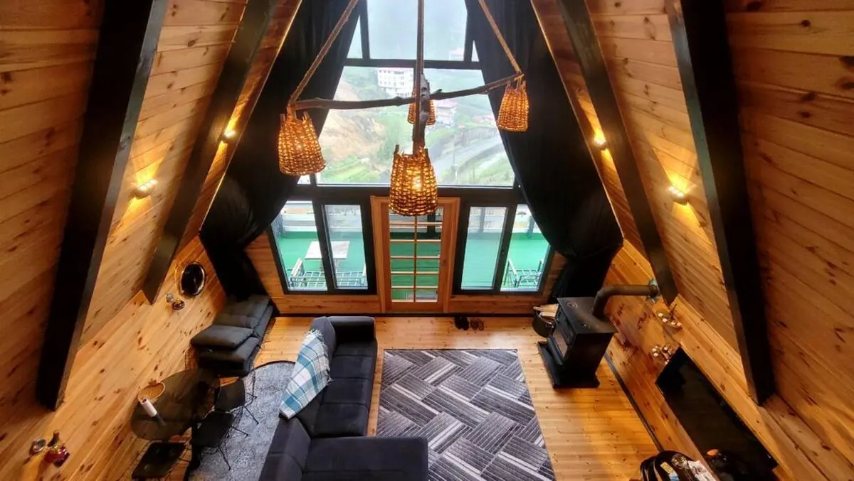
Bungalow 1 - 70m² - up to 5 guests
1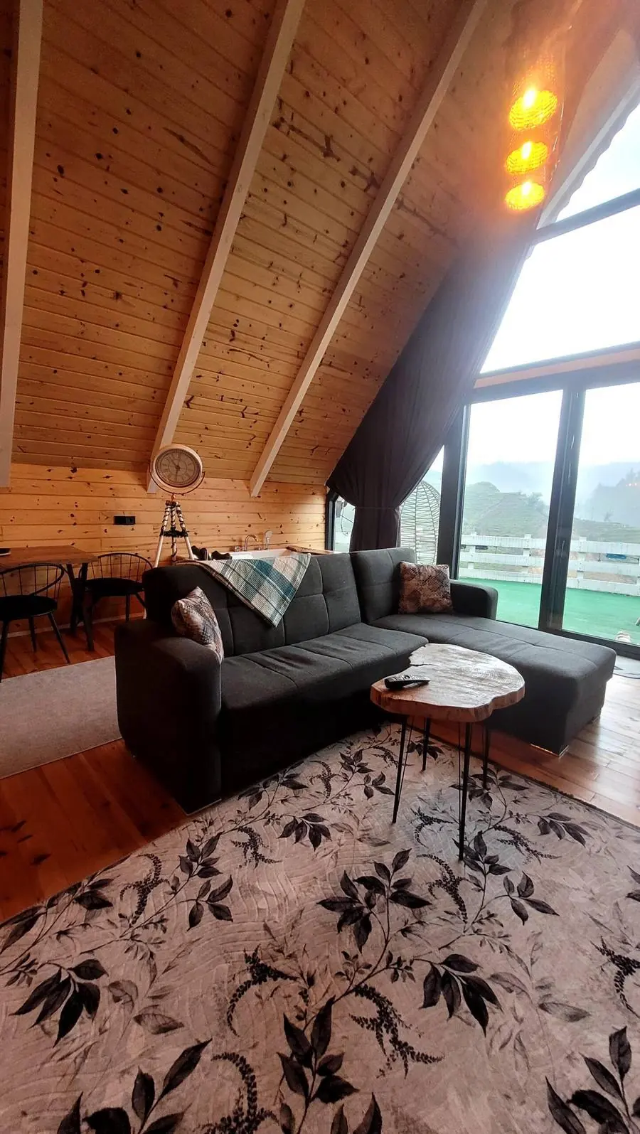
Designed for a comfortable family holiday, with its jacuzzi, children's room and wide balcony.
See Full Details →Bungalow 2 - 50m² - up to 6 guests
2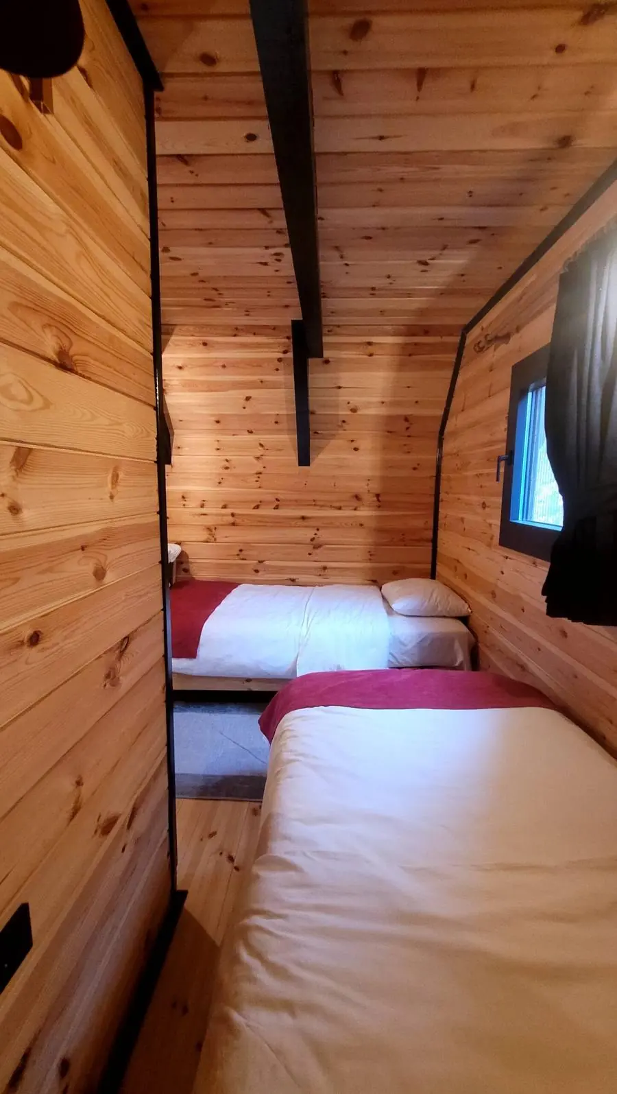
Complete privacy, with a loft railed in tree branches and a position set well away from the other buildings.
See Full Details →Bungalow 3 - 35m² - up to 3 guests
3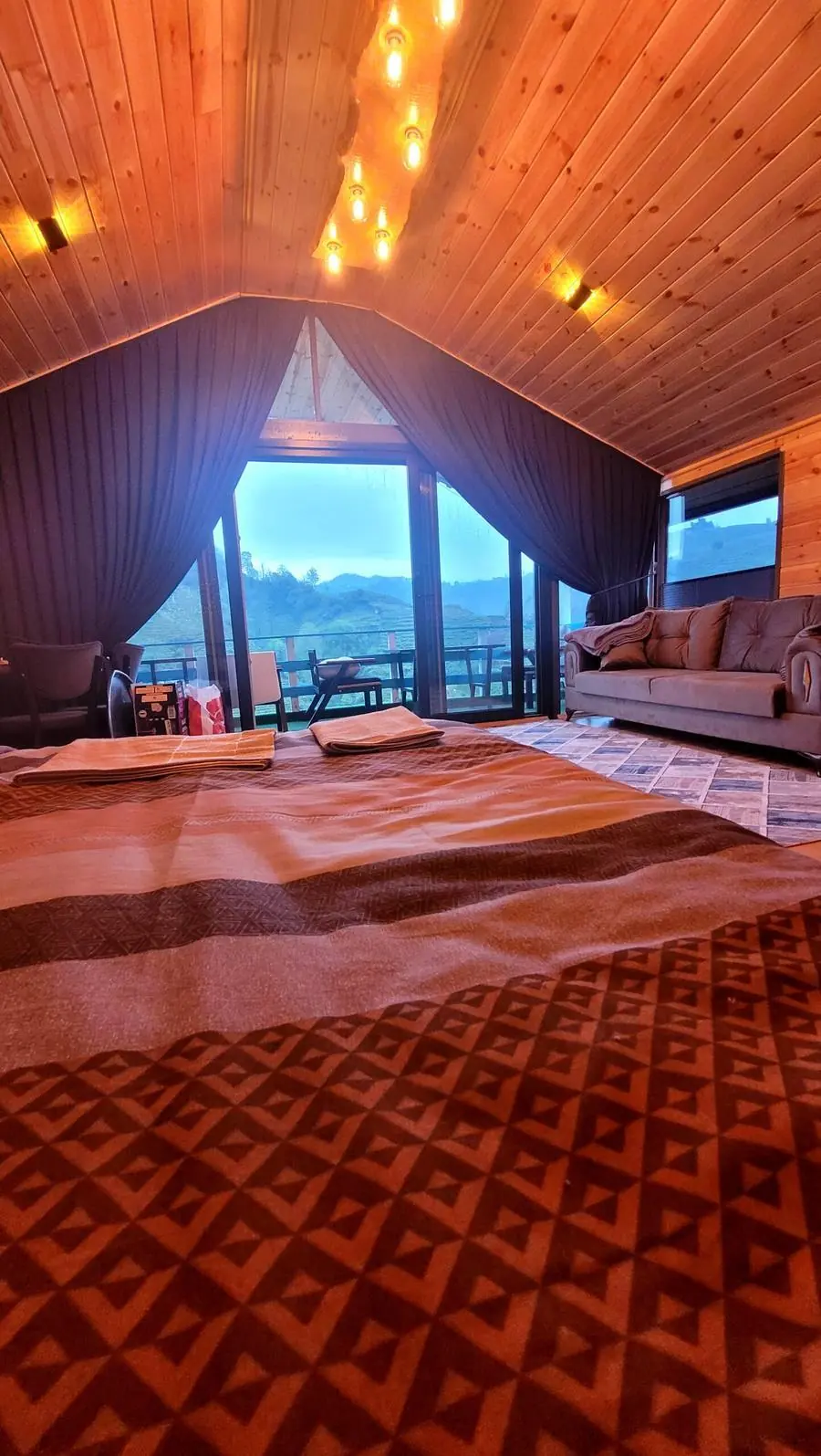
A romantic escape for up to 3 guests — coffee with an incomparable view in the gazebo perched in the treetop.
See Full Details →Before You Book
Pick your dates and bungalow, then ask directly via WhatsApp.
+90 507 345 15 34 Merkez Mah. Küme7 No: 28/2, Büyükköy — Çayeli / Rize
Every route on this page starts at the bungalow door. Message us directly for availability and pricing.